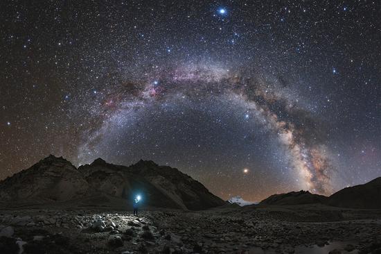
RIGHT BG


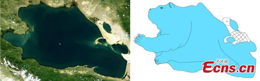
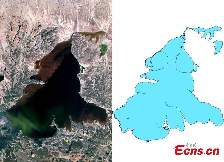
The combo picture shows satellite image of Qinghai Lake and the lake’s cartoon version painted by researchers of Qinghai Geological Survey Institute in Xining, northwest China’s Qinghai province. Based on shapes of lakes’ satellite images, talented researchers of the institute created cartoon characters. (Photo provided to China News Service)
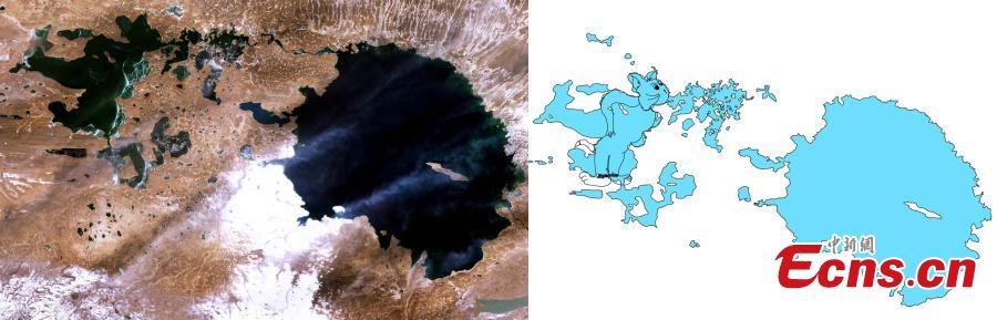
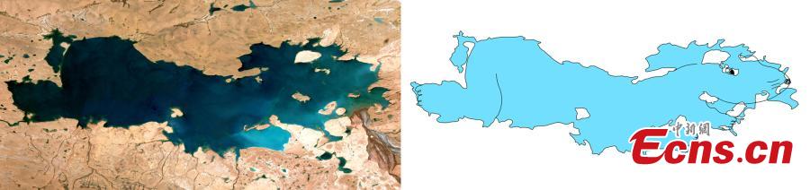
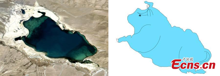
The combo picture shows satellite image of a lake and its cartoon version painted by researchers of Qinghai Geological Survey Institute in Xining, northwest China’s Qinghai province. Based on shapes of lakes’ satellite images, talented researchers of the institute created cartoon characters. (Photo provided to China News Service)
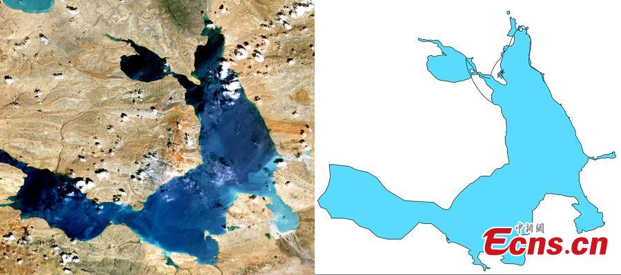
The combo picture shows satellite image of a lake and its cartoon version painted by researchers of Qinghai Geological Survey Institute in Xining, northwest China’s Qinghai province. Based on shapes of lakes’ satellite images, talented researchers of the institute created cartoon characters. (Photo provided to China News Service)
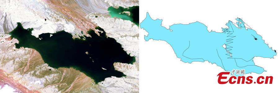
The combo picture shows satellite image of a lake and its cartoon version painted by researchers of Qinghai Geological Survey Institute in Xining, northwest China’s Qinghai province. Based on shapes of lakes’ satellite images, talented researchers of the institute created cartoon characters. (Photo provided to China News Service)
The combo picture shows satellite image of a lake and its cartoon version painted by researchers of Qinghai Geological Survey Institute in Xining, northwest China’s Qinghai province. Based on shapes of lakes’ satellite images, talented researchers of the institute created cartoon characters. (Photo provided to China News Service)
The combo picture shows satellite image of a lake and its cartoon version painted by researchers of Qinghai Geological Survey Institute in Xining, northwest China’s Qinghai province. Based on shapes of lakes’ satellite images, talented researchers of the institute created cartoon characters. (Photo provided to China News Service)
The combo picture shows satellite image of a lake and its cartoon version painted by researchers of Qinghai Geological Survey Institute in Xining, northwest China’s Qinghai province. Based on shapes of lakes’ satellite images, talented researchers of the institute created cartoon characters. (Photo provided to China News Service)