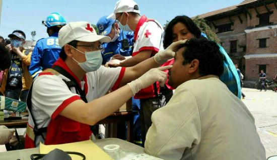
A Chinese doctor treats a Nepali patient on Sunday who was affected by the magnitude-7.9 earthquake in Kathmandu. (Cheng Ying/Xinhua)
A disaster relief group formed by scientists from the Chinese Academy of Sciences has spotted a number of serious secondary disasters in Nepal, which was hit by a devastating earthquake in late April. [Special coverage]
Over the weekend, Chinese scientists analyzed data sent from Gaofen 1, a high-resolution Chinese satellite, and located several new hazards including mudslides, landslides and barrier lakes.
Among these, the most severe took place in the Rasuwa region, with many landslides spotted along the slopes of the China-Nepal Highway and a 0.3 square kilometer barrier lake threatening downstream villages.
"The remote sensing images can help us locate the exact place where secondary disasters take place, but to learn the specific situation at those sites in order to provide advice for disaster relief, we still need on-site investigation," said Cui Peng, a well-known geological hazard professor, who led a 12-person team to Nepal only five days after the earthquake.
"Strong earthquakes that occur in mountain regions cause various secondary disasters, and we can use the experiences we learned in the 2008 Wenchuan earthquake to help assess the risk and remediate the disaster here," Cui said.
Since the early 1980s, the Chinese Academy of Sciences has been working with the International Centre for Integrated Mountain Development, an intergovernmental organization based in Kathmandu.
Being the first group of foreign experts arriving in Nepal after the earthquake, the Chinese scientists immediately formed a joint working group with the international center and Tribhuvan University to identify locations that need urgent supplies, carry out risk assessment for secondary disasters and evaluate loss of infrastructure like roads and power stations.
In the coming days, the Chinese experts will use satellite images to assess the safety of roads linking disaster-affected areas and will carry out field research once safe roads are reopened.