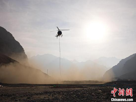
China's first helicopter airborne magnetotelluric detection system has been successfully applied to a plateau railway construction project, the Chinese Academy of Sciences' Aerospace Information Research Institute (AIR) said on Tuesday.
Researchers have used the system to conduct geological surveys of high-altitude regions with extremely cold temperatures, complex terrain and harsh environments, providing critical data support for the project.
Airborne magnetotelluric detection technology involves the use of aircraft-mounted high-sensitivity magnetic field sensors to capture subsurface electromagnetic response signals generated by Earth's natural magnetic fields, said Huang Ling, an associate researcher at AIR.
Data inversion is then applied to map underground features such as faults, fissures, groundwater and mineral resources, Huang said.
Airborne magnetotelluric detection has advantages such as rapid deployment capabilities, high resolution imagery and broad coverage, making it a vital tool for resource exploration and engineering surveys.
It is particularly suited to underground detection in challenging environments where human access is limited, such as plateaus, forests, deserts and swamps.
To develop China's first helicopter-borne system of this kind, the AIR research team has overcome a series of core technical challenges, including those related to high-sensitivity magnetic sensors, high-dynamic-range signal receivers and stabilized aerial payload platforms. The system's technical specifications have met advanced international standards.
During a nearly two-month survey in harsh, high-altitude and extremely cold conditions, the research team completed more than 30 flights covering over 5,000 kilometers.
"We will continue advancing the iterative development and technological innovation of this system to support national major engineering projects and mineral resource exploration," Huang said.


 京公網(wǎng)安備 11010202009201號