


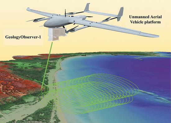
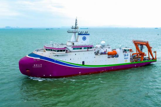
A rendered image of Geology-Observer-1. (CHINA DAILY)
A new device developed by Chinese researchers enables high-definition, 3D surface modeling for both land and water, supporting environmental monitoring and resource surveying in complex landscapes.
The device, named GeologyObserver-1, is an airborne photon-counting LiDAR system designed for integrated land and sea remote sensing and intelligent detection.
LiDAR, which stands for Light Detection and Ranging, is a remote sensing method that uses light in the form of pulsed lasers to measure variable distances to the Earth. LiDAR systems generate precise, 3D information about the shape and surface characteristics of the Earth's terrain and objects.
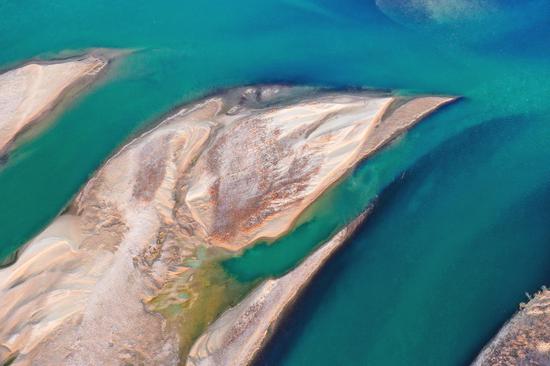
Complex geological environments such as plateaus, rugged mountains, hills and islands account for a significant portion of China's land area. These regions feature diverse landforms, intricate geological structures and harsh climatic conditions, posing substantial challenges to human life and socioeconomic development.
Many of the nation's resources, including natural gas, oil and minerals, are predominantly located in these complex geological environments. Likewise, many large-scale hydroelectric projects are situated in high mountain gorges, making effective surveying of these regions crucial.
According to Wang Lizhe, a professor at the China University of Geosciences (Wuhan) in Hubei province, the newly developed GeologyObserver-1 sets itself apart from previous domestic devices with broader application prospects.
The device is expected to enhance survey efficiency and ensure investigator safety through cutting-edge technology.
GeologyObserver-1 can be mounted on various platforms, including fixed-wing and rotary-wing drones. It is suitable for island, reef and coastal zone surveys, detecting and accurately identifying small underwater targets, Wang explained.
Compared to shipborne sonar's low detection efficiency and the limited accuracy of optical satellite remote sensing, GeologyObserver-1 offers significant advantages. It features a smaller receiving field of view and stronger suppression of multiple scattering effects of lasers in water. These capabilities allow it to detect faint light effectively, improving depth measurement accuracy.
"We've tested it for integrated land and water terrain mapping of Weizhou Island in the Guangxi Zhuang autonomous region and the Nansha Islands," Wang said, adding that further applications are anticipated in underwater surveys, including water pollution monitoring and beach and port management.
"For ports, the underwater terrain of ship channels and berths is crucial for operational safety and efficiency. To ensure the safe berthing of large cargo vessels and smooth navigation, port authorities must regularly survey underwater terrain to assess sedimentation levels and the stability of underwater structures," Wang said. "GeologyObserver-1 can provide critical data for port managers."
Additionally, GeologyObserver-1 can collect farmland data and generate precise 3D crop models, analyzing plant attributes such as height, canopy width and leaf area. These capabilities support crop health monitoring, yield prediction, weed detection and field terrain analysis.
"GeologyObserver-1 is primarily aimed at the low-altitude economic market, which is currently booming," Wang said. "Real-life 3D modeling, LiDAR and coastal zone mapping represent billion-dollar markets supported by the government and hold broad prospects for future applications."
Wang and his team are collaborating with the Shanghai Institute of Optics and Fine Mechanics at the Chinese Academy of Sciences to enhance the device's functionality and reduce its cost.
Tao Bangyi, a researcher at the Second Institute of Oceanography under the Ministry of Natural Resources, said GeologyObserver-1 achieved dual-frequency land-water integrated detection using a photon-counting detection system, with "hardware indicators reaching the domestic leading level and internationally advanced standards".


 京公網(wǎng)安備 11010202009201號