


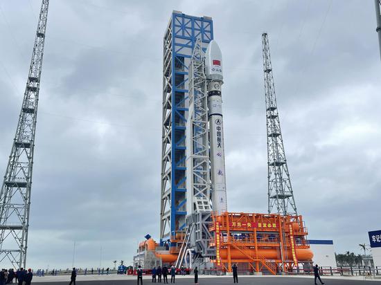
China Satellite Navigation Office (CSNO) on Thursday released major plans for the next stage of Beidou Navigation Satellite System (BDS), featuring cutting-edge technologies and enhanced services. The plan includes the launch of three pilot test satellites around 2027 and the completion of the system by 2035.
The BDS Development Plan for 2035 was announced on Thursday at a symposium in Beijing to mark the 30th anniversary of the Beidou project. More than 100 participants attended the event, including representatives from national authorities, as well as key personnel from the project's engineering leadership and design teams.
The new plan outlines the future of China's satellite navigation network. "Building on the stable operation of the BDS-3, China aims to establish a next-generation BDS that is more advanced, robust, and user-focused," the Global Times learned from the event.
The timeline specifies that breakthroughs in key technologies are expected by 2025. By 2027, three pilot satellites will be launched to test new technologies, and by 2029, the deployment of the system's network satellites will begin. The full completion of the next-generation BDS is expected by 2035, according to the plan.
The new system will feature characteristics like accuracy, flexibility, intelligence, and adaptability, offering global users real-time, high-precision, and highly reliable navigation, positioning, and timing services across Earth and near-Earth spaces, with accuracy ranging from meter-level to decimeter-level.
The system will cater to a variety of user terminals spanning from Earth's surface to deep space, and seamlessly integrate with other non-satellite-based navigation and timing technologies.
The CSNO noted that the next-generation BDS will optimize the constellation architecture, forming a hybrid configuration of high-, medium- and low-orbit to enhance the accuracy of time-space benchmarks and the system's autonomous operation capabilities.
An integrated and efficient ground system will also be established to ensure resource flexibility, data sharing, and continuous operations, according to the office.


 京公網安備 11010202009201號