


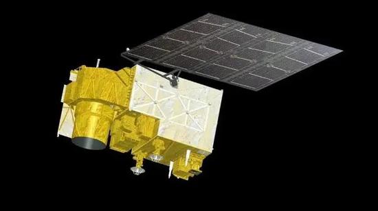
The Atmospheric Environmental Surveyor (Photo/China Aerospace Science and Technology Corporation)
China started formal operation of two advanced environmental protection satellites on Thursday, the China National Space Administration said.
At a handover ceremony at the administration's Beijing headquarters, control of the satellites — the Atmospheric Environmental Surveyor and the Terrestrial Ecosystem Carbon Inventory Satellite — was officially given to their users, which include the National Forestry and Grassland Administration, the China Meteorological Administration, and the ministries of ecology and environment, agriculture and rural affairs, natural resources, and emergency management.
Meng Lingjie, director of the CNSA's Earth Observation and Data Center, said after the ceremony that the two spacecraft represent the Chinese government's commitment to using space technology to facilitate global environmental protection efforts, and they have world-class capabilities.
Over the past two years, they have undergone comprehensive in-orbit performance tests and engaged in trial operations. Their service has improved the efficiency and accuracy of carbon sink measurement, and boosted the country's carbon peaking and neutrality efforts, he said.
The Terrestrial Ecosystem Carbon Inventory Satellite, named after Goumang, the god of forestry, spring and the Orient in ancient Chinese mythology, was launched in August 2022 from the Taiyuan Satellite Launch Center in North China's Shanxi province.
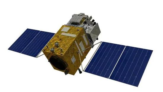
The Terrestrial Ecosystem Carbon Inventory Satellite (Photo/China Aerospace Science and Technology Corporation)
It is traveling in a sun-synchronous orbit 506 kilometers above Earth.
Designed and built by the China Academy of Space Technology, it has four mission payloads — a laser radar, a multi-angle multispectral camera, a hyperspectral detector and a polarization imager.
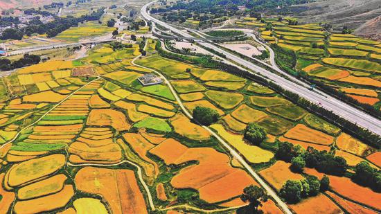
The satellite can detect and measure vegetation biomass and atmospheric aerosol and chlorophyll fluorescence, and can also obtain remote-sensing information about global forest carbon sinks.
It is mainly tasked with detecting and measuring carbon elements in ecosystems, especially in forests.
It also has been used to monitor and survey terrestrial ecosystems and resources, track and evaluate major environmental protection projects, monitor the atmospheric environment and obtain data about the effect of aerosols on climate change.
The satellite has also provided support in other fields, such as agricultural forecasting and disaster relief.
The Atmospheric Environmental Surveyor was launched in April 2022 from the Taiyuan center and now flies in a sun-synchronous orbit at an altitude of 705 km.
Built by the Shanghai Academy of Spaceflight Technology, it is equipped with five cutting-edge mission payloads, including a directional polarimetric camera and an atmospheric trace gas differential absorption spectrometer.
The satellite is being used to observe air pollution, greenhouse gases and other environmental elements. It has been providing data for research on climate and ecological changes, and will help to forecast agricultural yields and hazards.


 京公網(wǎng)安備 11010202009201號