


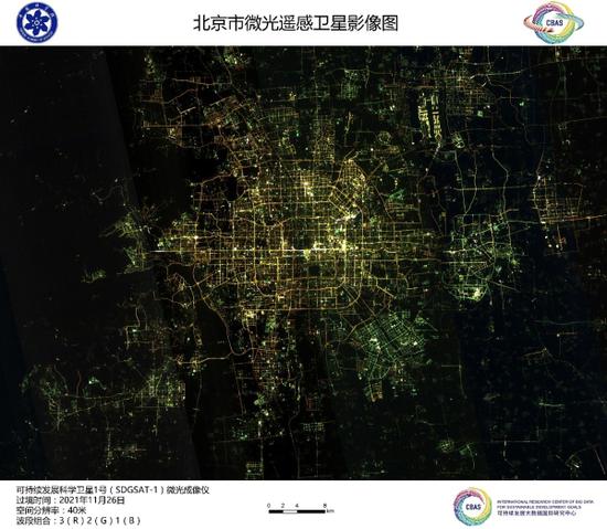
An image of Beijing City taken by the satellite SDGSAT-1, November 26, 2021. /International Research Center of Big Data for Sustainable Development Goals
Ten images taken by Chinese satellite SDGSAT-1 to help meet UN Sustainable Development Goals were unveiled in Beijing on Monday.
It is the first time the satellite images are released after its launch on November 5 from Taiyuan Satellite Launch Center, north China's Shanxi Province.
SDGSAT-1 used three different imagers to take remote sensing pictures of Paris, France and various areas in China, including Beijing, Shanghai and the Yangtze River Delta region.
It is the very first satellite on Earth to help achieve 17 goals in the "2030 Agenda for Sustainable Development" set by the UN in 2015 to stimulate actions in solving social, economic and environmental problems for humanity and the planet.


 京公網安備 11010202009201號