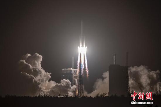
China plans to launch a new Synthetic Aperture Radar (SAR) imaging satellite for monitoring Arctic shipping routes, the satellite developers said Thursday.
Jointly developed by scientists from Guangzhou-based Sun Yat-sen University and the China Academy of Space Technology, the satellite has been designed to be put in a sun-synchronous orbit at an altitude of 720 km and to generate high-quality SAR satellite imagery with 50-meter resolution and 300 km width.
According to lead scientist Cheng Xiao of the Sun Yat-sen University, the satellite is capable of providing a one-day revisit of most areas along maritime paths across the Arctic. Its data will be used to monitor and predict sea ice, climate change and marine disasters, offering important data support for the safety of Arctic shipping routes.
Fast and high-precision monitoring of Arctic sea ice has become an urgent task for scientists. However, current in-orbit SAR satellites cannot fully meet the requirement, Cheng said, adding that the new satellite is expected to improve China's polar monitoring capability.
The SAR satellite is likely to be launched in 2022.