


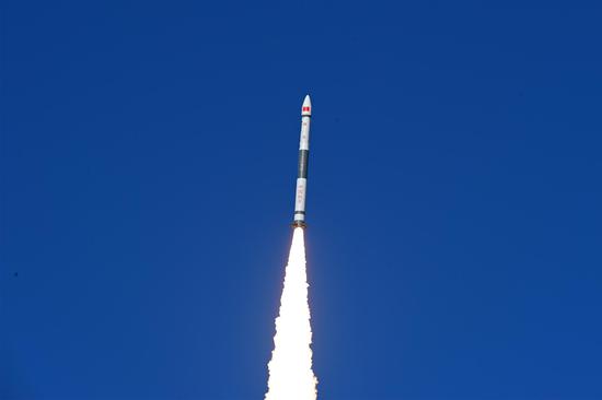
China launched a Long March-2D carrier rocket into space on Thursday evening carrying a wheel-like formation of four remote sensing satellites, the first formation of its kind in the world.
The satellites of the PIESAT-1 constellation were launched at 6:50 p.m. (Beijing Time) from the Taiyuan Satellite Launch Center in northern China's Shanxi Province, and then entered a preset orbit.
WHEEL FORMATION
The in-orbit constellation has formed a lineup like a vehicle wheel. It comprises a primary satellite running at the central "axle" and three supplementary satellites evenly placed in an elliptical "wheel hub" and orbiting the primary satellite. The supplementary trio is located just a few hundred meters from the primary satellite.
The constellation is capable of maintaining its stability and space safety, thanks to precise orbital control supported by inter-satellite links and phase synchronization links.
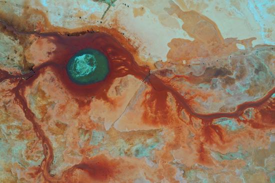
The four satellites are equipped with interferometric synthetic aperture radars (InSARs), which are effective tools to measure changes in land surface.
The InSARs capture two images at different times by reflecting radar signals off a target area on Earth, and then have them interfere with each other to produce maps called interferograms, which reveal the ground-surface displacement between the two time periods.
Unlike visible or infrared light, radar waves can penetrate most weather clouds and are equally effective in darkness.
DISASTER PREVENTION
Compared to traditional InSARs, a wheel formation can generate more interference baselines, thus increasing mapping efficiency.
The constellation, mainly used to provide commercial remote-sensing data services, is capable of conducting rapid high-efficiency global land surveys.
It can realize millimeter-level deformation monitoring to identify land subsidence, surface collapses and landslides, meaning it is an effective weapon for the early detection of major geological disasters.
The constellation has the full-time, all-weather ability to take high-quality, submeter-scale, broad-width images of our planet.
It was designed by the satellite maker Galaxy Space (Beijing) Network Technology, and it will be used by PIESAT, a satellite operation and application services provider in China.
The Long March-2D carrier rocket is a two-stage launch vehicle with a take-off thrust of 300 tonnes, and it is capable of lifting 1.3-tonne payloads to the solar synchronous circular orbit 700 km above Earth.
This mission was the 469th flight of the Long March carrier rockets.


 京公網安備 11010202009201號