


China's high-resolution multi-mode imaging satellite has been officially put into use, according to the China National Space Administration (CNSA) Thursday.
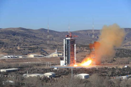
The satellite was launched on July 3, 2020 from the Taiyuan Satellite Launch Center in north China's Shanxi Province. The summary review of its in-orbit test was completed on December 17, 2021.
The test results show that the satellite is in good condition, works well, and has the conditions for putting into use, said the CNSA.
It is a civil optical remote-sensing satellite with a resolution up to the sub-meter level.
The satellite can provide high-precision remote-sensing image data for industries including surveying and mapping, natural resources, emergency management, agriculture, ecological environment, residential construction and forestry.
This is China's first civil space research project adopting the public-private partnership model. The government is responsible for the development, data reception and processing of satellite images.


 京公網(wǎng)安備 11010202009201號