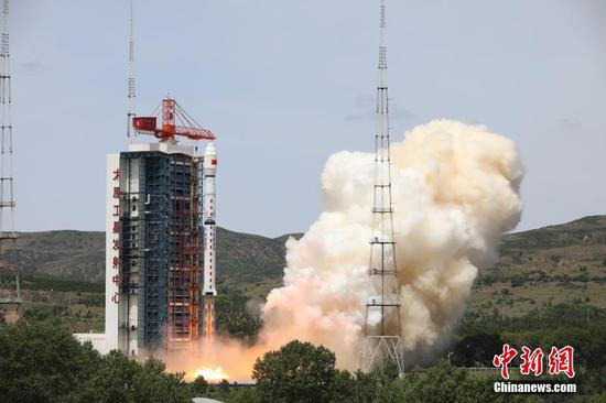
The Chinese Academy of Sciences (CAS) on Tuesday confirmed that China has successfully received data from the newly launched high-resolution multi-mode imaging satellite.
The satellite, launched on July 3, is a civil-use optical remote-sensing satellite with a resolution up to the sub-meter level. According to the Aerospace Information Research Institute under the CAS, China's remote sensing satellite ground station in Beijing's Miyun District first tracked and received the downlink data on July 3.
The ground stations in Kashgar in Xinjiang Uygur Autonomous Region and Sanya in Hainan Province, as well as the China Remote Sensing Satellite North Pole Ground Station, have also confirmed reception of the satellite data.
As of Monday, the remote sensing satellite ground stations have received 1,012 GB of data, which are being processed normally.
The satellite can provide high-precision remote-sensing image data for several industries including surveying and mapping, natural resources, emergency management, agriculture, ecological environment, residential construction and forestry.