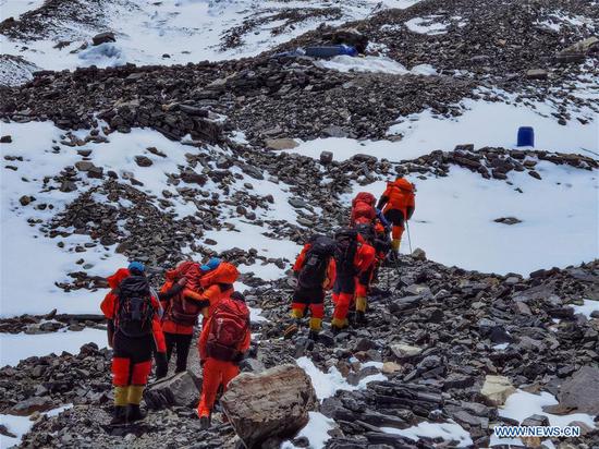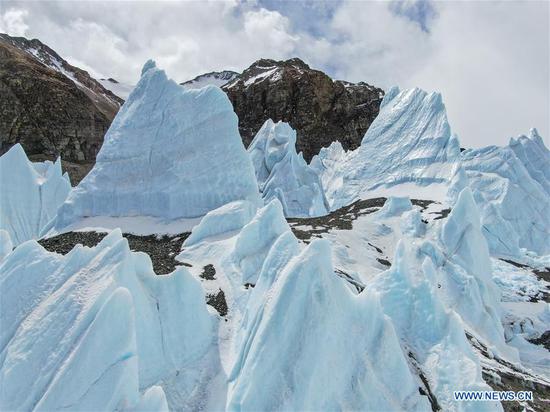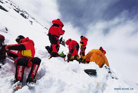
Members of a Chinese team set out from a camp at an altitude of 6,500 meters on Mount Qomolangma in the Tibet autonomous region on May 24, 2020. They are scheduled to reach the summit of the world's highest mountain on Wednesday. (Photo/Xinhua)
Team continues mission to measure height after heavy snow causes delays
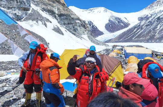
Chinese surveyors and mountaineers arrived at a camp on Mount Qomolangma at an altitude of 7,790 meters on Monday, with all team members in good health, the Ministry of Natural Resources said on Monday evening.
"Our team has successfully pitched tents in heavy winds. But the weather report shows the wind will weaken tomorrow evening, which will be good news for us," said Tsenor, head of the Chinese Mountaineering Team and leader of the mission. The climbers are expected to reach the summit on Wednesday.
The team is making its third attempt this month to reach the peak of the world's highest mountain. Two attempts in past weeks failed due to a change in weather that resulted in heavy snow.
A team of Chinese surveyors left a base at an altitude of 6,500 meters on Sunday afternoon for a higher spot on their journey to the peak as they endeavor to fulfill a mission to remeasure the height of Qomolangma, known as Mount Everest in the West.
Mount Qomolangma sits on the China-Nepal border, with its northern part in Shigatse in the Tibet autonomous region.
Earlier this month, China launched a campaign to measure the mountain's height again.
Since the founding of the People's Republic of China in 1949, Chinese surveyors have conducted six rounds of measurement and scientific research on Qomolangma and have released the height of the peak twice-it stood at 8,848.13 meters in 1975, and at 8,844.43 meters in 2005.
The remeasurement has been jointly organized by the Ministry of Natural Resources, the Ministry of Foreign Affairs, the General Administration of Sport of China and the Tibetan regional government.
Members of the Ministry of Natural Resources' 1st Geodetic Surveying Brigade and the national mountaineering team are carrying out the project.
Three members of the combined team, including two from the 1st Geodetic Surveying Brigade, have no previous experience climbing mountains higher than 8,000 meters.
If they feel uncomfortable after leaving the C1 camp at 7,028 meters, backup team members will take their places. Equipment for measuring the height of the summit will be taken to the top by a special team of climbers, the ministry said.
Technical innovations and breakthroughs applied in the survey include the application of the Beidou 3 Navigation Satellite System and advanced domestic surveying and mapping instruments.
"The core of the mission is to accurately measure the height of Mount Qomolangma, which can be used for research in fields such as geodynamics," said Jiang Tao, an associate researcher from the Chinese Academy of Surveying and Mapping.