Since 2002, the number of bird species in the delta wetland has risen from 283 to 368 and the bird population has reached 3 million to 4 million. (PHOTO/XINHUA)
Abundant water
The river rises in the heart of the Qinghai-Tibet Plateau and runs for 5,464 km through nine provinces before flowing into Bohai Bay. It is China's second-longest river after the Yangtze, and the world's sixth longest.
Nearly 6,000 years ago, the country's earliest agricultural communities and activities boomed on the plateau as a result of the area's fertile soil, abundant water supplies and humid weather.
Li Fengjiang, a geological researcher at the Chinese Academy of Sciences, told Chinese National Geography magazine, "The rich deposits of microfossils indicate the Loess Plateau used to be covered with thick plants, and later grasses, just 20,000 years ago", indicating a combination of fertile soil and a humid climate.
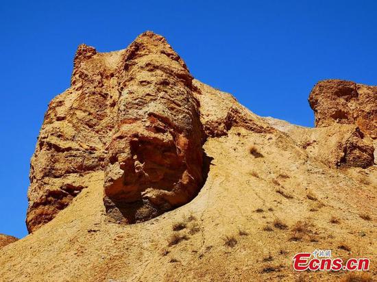
The Loess Plateau was made up of sand and soil carried by wind from deserts in Northwest China. The sand and soil were blocked by mountain ranges in the south and east of the plateau.
The soil layer on the plateau is dozens of meters deep, compared with a typical depth of 1 to 1.5 meters, providing a solid foundation for agriculture to thrive over thousands of years, Li added.
Li Qinye, a geography and resources researcher with the Chinese Academy of Sciences, said, "Although human activities on the Loess Plateau have caused serious soil erosion, ecological restoration projects and strict control of population growth can change the environment and ensure sustainable development in the region."
Yang said, "Local residents' environmental awareness should be raised and the population should be concentrated in more-habitable places to ease the burden on this vast area."
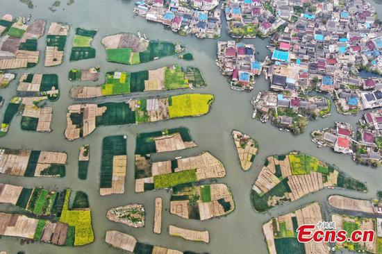
It is estimated that in the 20th century the Yellow River carried 1.6 billion tons of silt on average from the Loess Plateau each year, of which about 1 billion tons ended up in Bohai Bay. Of this, 40 percent was deposited in the river estuary, and the rest on the riverbed on its course to the sea, elevating the riverbed.
But the huge load of silt-an invaluable agricultural and environmental asset for those living on the middle reaches of the river and in Dongying-is a problem for people living in downstream areas of the river, mainly in Henan and Shandong, which are home to about 200 million citizens. They must build higher dykes in case the river overflows its banks.
Silt that piled up led to several deadly floods on the middle reaches of the Yellow River when it overflowed.
For example, flooding in 1332 and 1333 during the Yuan Dynasty (1271-1368) claimed about 7 million lives, reportedly the heaviest death toll caused by a natural disaster in human history. Flooding in 1887 during the Qing Dynasty (1644-1911) took 900,000 to 2 million lives.
Many cases of flooding triggered public anger and led to those in power being overthrown.
The Yellow River has also been used as a "weapon". In the 17th and 20th centuries, dykes were opened to flood vast areas of land in a bid to block advancing rebel farmers and Japanese invaders.
The elevated riverbed means it is almost impossible for subsiding floodwater to find its way back to the river. Instead, it merely flows to lower-lying land and nearby rivers. During this process, the Yellow River has changed its course.
Statistics from the Yellow River Conservancy Commission, founded by the Communist Party of China in 1946 to control the river in Zhengzhou, Henan, show it flooded 1,593 times from 595 BC to 1946, and had shifted its course 26 times.
The estuary area has fluctuated from the Haihe River in the north, which flows into Bohai Bay, to the Huaihe River in the south, which flows into the Yellow Sea. The two river mouths are nearly 900 km apart.
Frequent flooding and related natural disasters have prompted efforts to minimize the financial implications, with large areas of land earmarked as zones to control flooding.