RIGHT BG


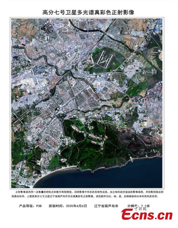
An aerial photo of Huludao City, NE China’s Liaoning Province, taken by Gaofen-7, June 6, 2020. China's Earth observation satellite Gaofen-7 has been officially put into use,according to the China National Space Administration (CNSA) on Thursday. It's the country's first civil-use 3D surveying and mapping satellite that reaches the sub-meter definition. Objects less than a meter across can be detected, and the depth resolution can reach about 1.5 meters. Such satellites can be used for monitoring geographical conditions, housing and urban-rural construction and national statistics. (Photo provided by CNSA)
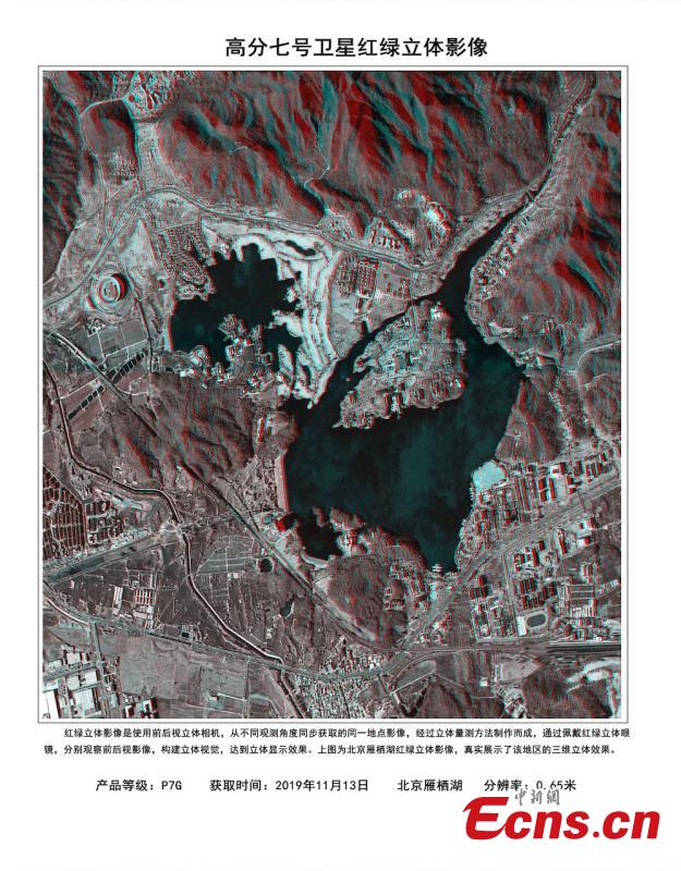
A 3D photo of Yanqi Lake in Beijing taken by Gaofen-7, Nov. 13, 2019. 3D red-cyan glasses are needed to view the image for the best experience. China's Earth observation satellite Gaofen-7 has been officially put into use,according to the China National Space Administration (CNSA) on Thursday. It's the country's first civil-use 3D surveying and mapping satellite that reaches the sub-meter definition. Objects less than a meter across can be detected, and the depth resolution can reach about 1.5 meters. Such satellites can be used for monitoring geographical conditions, housing and urban-rural construction and national statistics. (Photo provided by CNSA)
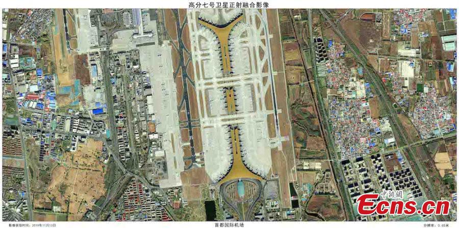
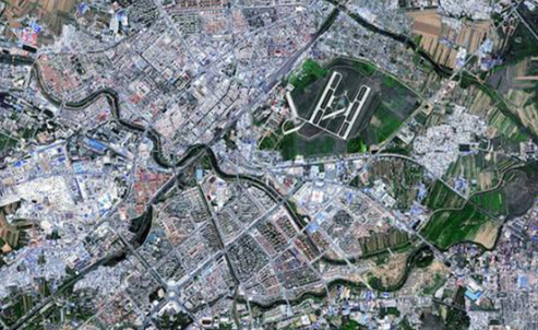
A photo of the Beijing Capital International Airport by Gaofen-7.China's Earth observation satellite Gaofen-7 has been officially put into use,according to the China National Space Administration (CNSA) on Thursday. It's the country's first civil-use 3D surveying and mapping satellite that reaches the sub-meter definition. Objects less than a meter across can be detected, and the depth resolution can reach about 1.5 meters. Such satellites can be used for monitoring geographical conditions, housing and urban-rural construction and national statistics. (Photo provided by CNSA)
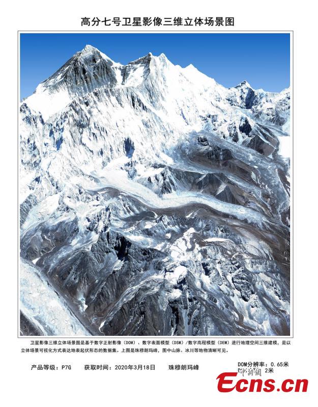
Photo of the world's highest peak Mt. Quomolangma, taken by Gaofen-7, March 18, 2020. China's Earth observation satellite Gaofen-7 has been officially put into use,according to the China National Space Administration (CNSA) on Thursday. It's the country's first civil-use 3D surveying and mapping satellite that reaches the sub-meter definition. Objects less than a meter across can be detected, and the depth resolution can reach about 1.5 meters. Such satellites can be used for monitoring geographical conditions, housing and urban-rural construction and national statistics. (Photo provided by CNSA)