RIGHT BG


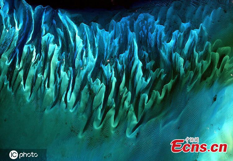
Captured in January 2001, this satellite image shows sand and seaweed beds in the Bahamas, which have been sculpted by tides and currents. (Photo/IC)
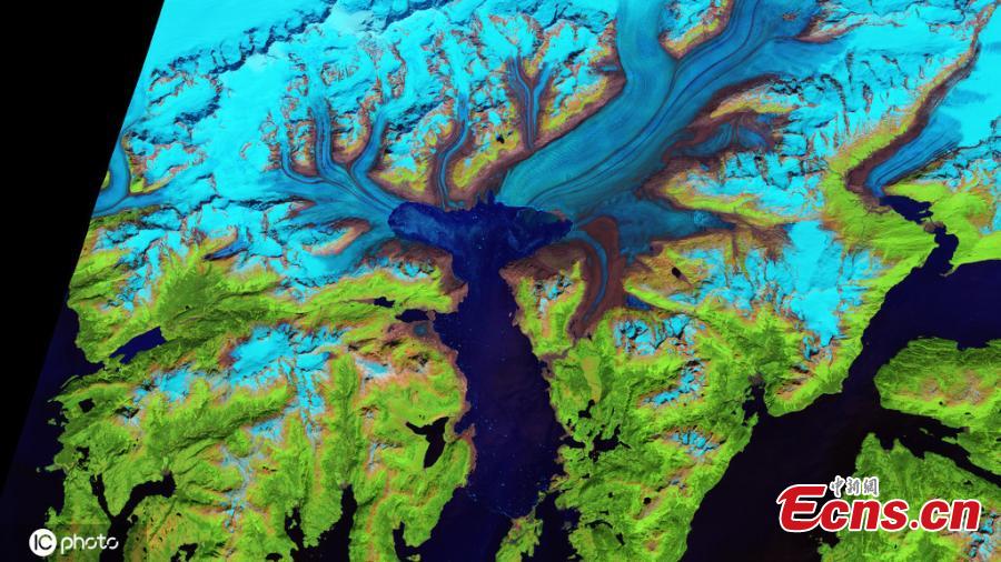
Taken in July 2014, this false colour image, which was taken by the Operational Land Imager on a satellite, shows the retreat of the Columbia Glacier in Alaska. (Photo/IC)
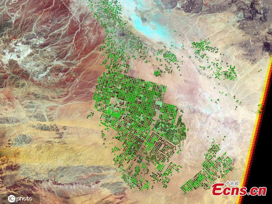
This image, created in 2012 using sensors, shows vegetation growing across the arid Wadi As-Sirhan Basin in Saudi Arabia. The green dots indicate new vegetation while the dry fields are rust-coloured. (Photo/IC)
This shot, captured in February 2012, shows the site of an underwater volcanic eruption near the fishing village of La Restinga on El Hierro in the Canary Islands. The scene was captured by the Advanced Land Imager (ALI) aboard the Earth Observing-1 (EO-1) satellite. (Photo/IC)