RIGHT BG


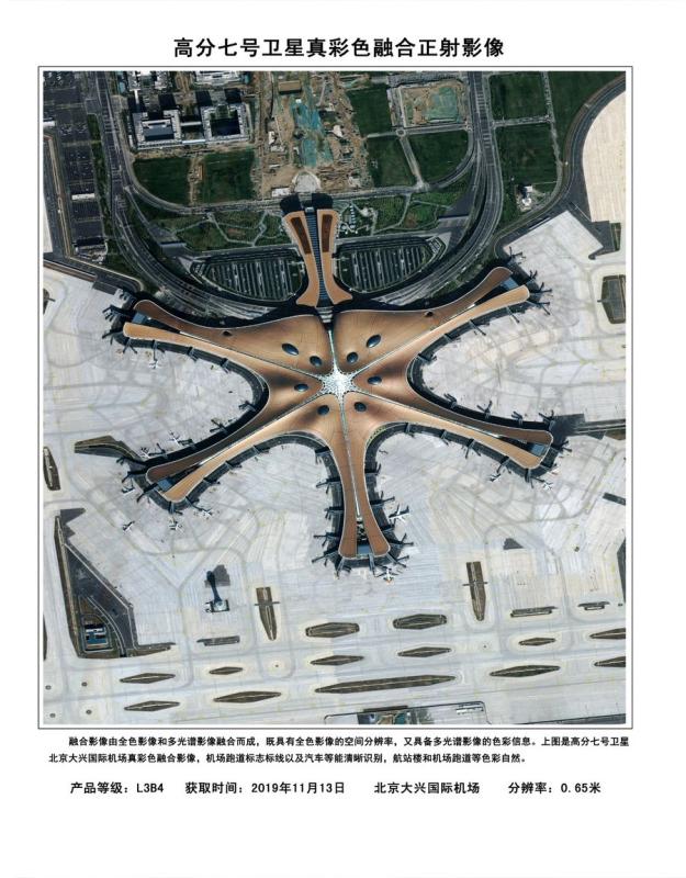
Image shows the fusion orthophoto image of the Beijing Daxing International Airport with 0.65 m resolution true color based on the data from the Gaofen-7 Earth observation satellite. The China National Space Administration Tuesday released the first batch of three-dimensional images based on the data from the recently launched Gaofen-7 Earth observation satellite. (Xinhua)
The 22 images unveiled show the Beijing Capital International Airport, the new Beijing Daxing International Airport, as well as some regions in China's Anhui, Guangdong and Shandong provinces. Airplanes, vehicles, buildings and trees can be clearly seen in the images.
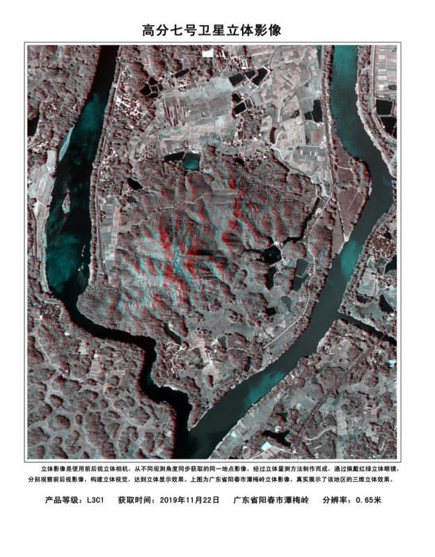
Image shows the stereo image of the Tanmei Mountain in Yangchun City of south China's Guangdong Province with 0.65 m resolution based on the data from the Gaofen-7 Earth observation satellite. The China National Space Administration Tuesday released the first batch of three-dimensional images based on the data from the recently launched Gaofen-7 Earth observation satellite. (Xinhua)
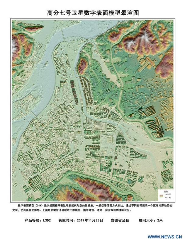
Image shows the relief map of the digital surface model of Jingxian County of east China's Anhui Province with the grid size of 2 m based on the data from the Gaofen-7 Earth observation satellite. The China National Space Administration Tuesday released the first batch of three-dimensional images based on the data from the recently launched Gaofen-7 Earth observation satellite. (Xinhua)
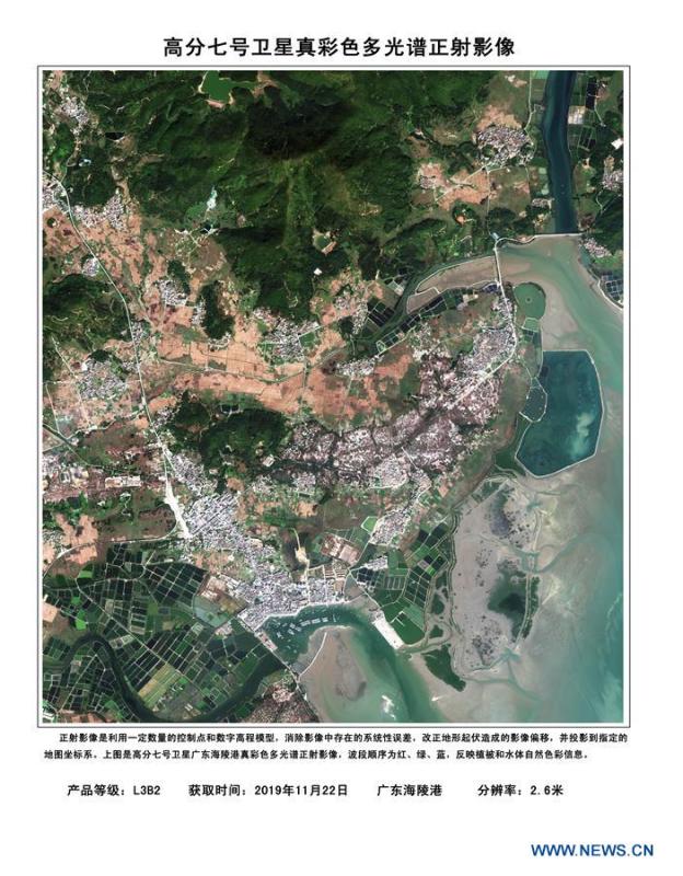
Image shows the multi-spectral orthophoto image of the Hailing port in south China's Guangdong Province with 2.6 m resolution true color based on the data from the Gaofen-7 Earth observation satellite. The China National Space Administration Tuesday released the first batch of three-dimensional images based on the data from the recently launched Gaofen-7 Earth observation satellite. (Xinhua)
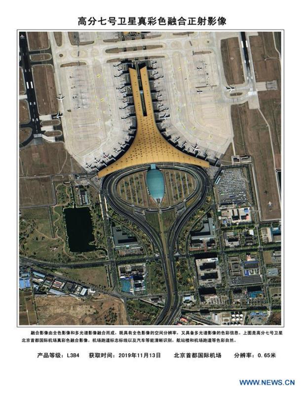
Image shows the fusion orthophoto image of the Beijing Capital International Airport with 0.65 m resolution true color based on the data from the Gaofen-7 Earth observation satellite. The China National Space Administration Tuesday released the first batch of three-dimensional images based on the data from the recently launched Gaofen-7 Earth observation satellite. (Xinhua)
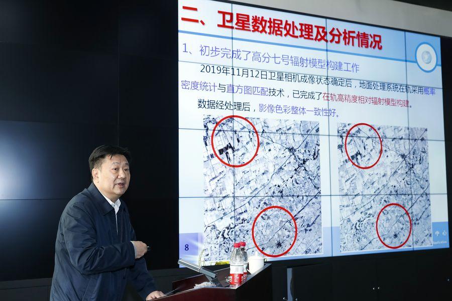
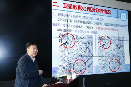
Xu Wenxiang, director of the China Center for Resources Satellite Data and Application, introduces the data processing of the Gaofen-7 Earth observation satellite during the launching ceremony of its first batch of three-dimensional images in Beijing, capital of China, Dec. 10, 2019. The China National Space Administration Tuesday released the first batch of three-dimensional images based on the data from the recently launched Gaofen-7 Earth observation satellite. (Xinhua/Shen Bohan)
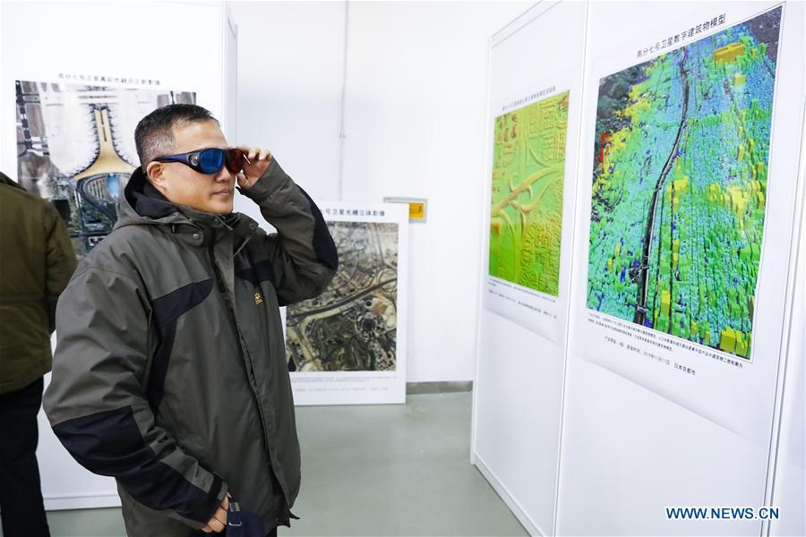
An attendee wearing three-dimensional glasses watches the first batch of three-dimensional images based on the data from the Gaofen-7 Earth observation satellite during the launching ceremony in Beijing, capital of China, Dec. 10, 2019. The China National Space Administration Tuesday released the first batch of three-dimensional images based on the data from the recently launched Gaofen-7 Earth observation satellite. (Xinhua/Shen Bohan)
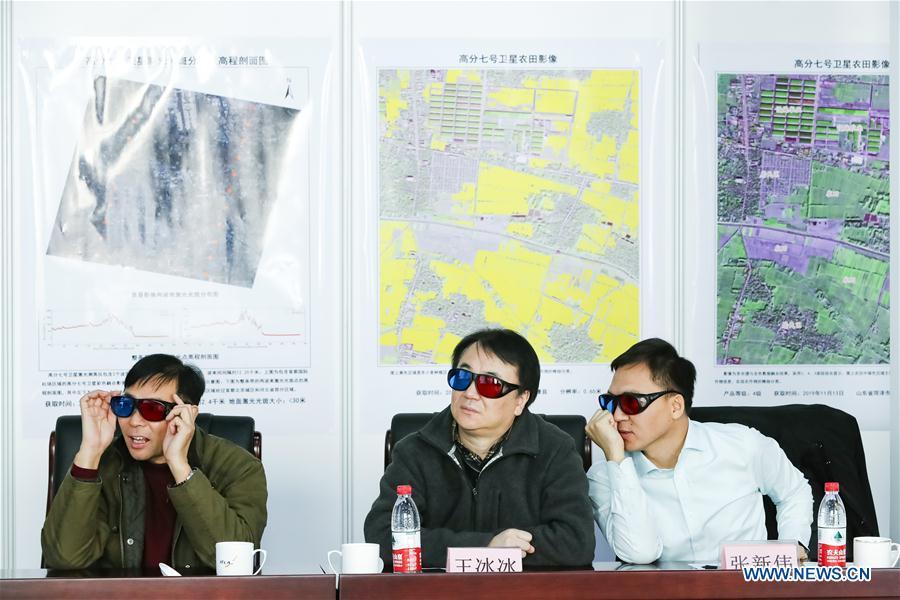
Attendees wear three-dimensional glasses to watch the first batch of three-dimensional images based on the data from the Gaofen-7 Earth observation satellite during the launching ceremony in Beijing, capital of China, Dec. 10, 2019. The China National Space Administration Tuesday released the first batch of three-dimensional images based on the data from the recently launched Gaofen-7 Earth observation satellite. (Xinhua/Shen Bohan)
Attendees wear three-dimensional glasses to watch the first batch of three-dimensional images based on the data from the Gaofen-7 Earth observation satellite during the launching ceremony in Beijing, capital of China, Dec. 10, 2019. The China National Space Administration Tuesday released the first batch of three-dimensional images based on the data from the recently launched Gaofen-7 Earth observation satellite. (Xinhua/Shen Bohan)
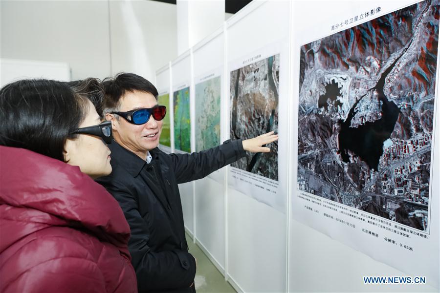
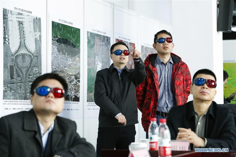
Attendees wear three-dimensional glasses to watch the three-dimensional image of Yanqi Lake of Beijing with 0.65 m resolution based on the data from the Gaofen-7 Earth observation satellite during the launching ceremony in Beijing, capital of China, Dec. 10, 2019. The China National Space Administration Tuesday released the first batch of three-dimensional images based on the data from the recently launched Gaofen-7 Earth observation satellite. (Xinhua/Shen Bohan)