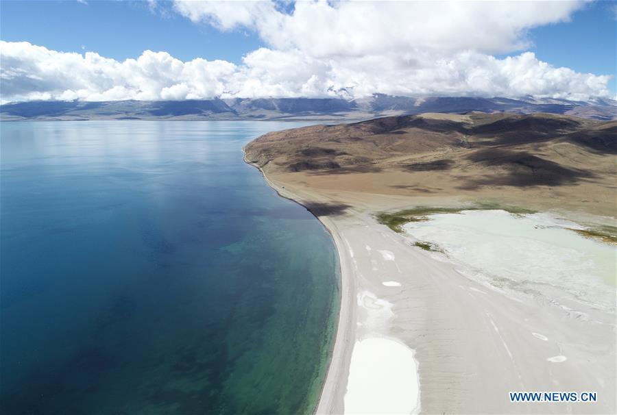
Aerial photo taken on Sept. 9, 2018 shows a view of Lake Manasarovar in Ngari, southwest China's Tibet Autonomous Region. The Ngari area has an average altitude of over 4,000 meters above sea level. (Xinhua/Purbu Zhaxi)
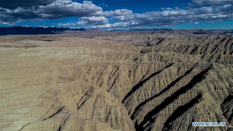
Aerial photo taken on Sept. 10, 2018 shows the scenery of earth forest in Ngari, southwest China's Tibet Autonomous Region. The earth forest is the sediment stratum of rivers and lakes in ancient times, formed by erosion of water. The Ngari area has an average altitude of over 4,000 meters above sea level. (Xinhua/Purbu Zhaxi)
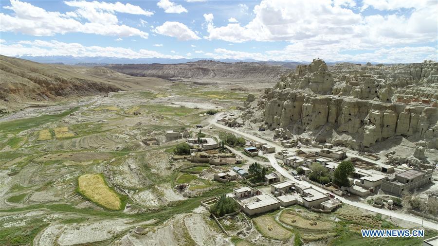
Aerial photo taken on Sept. 11, 2018 shows the ancient grottoes of Donggar on the hills in Ngari, southwest China's Tibet Autonomous Region. The Ngari area has an average altitude of over 4,000 meters above sea level. (Xinhua/Purbu Zhaxi)
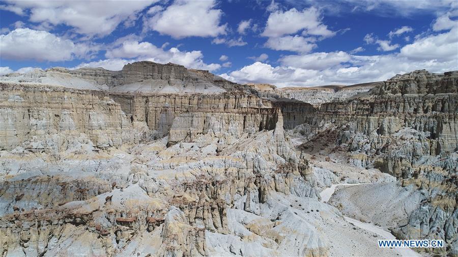
Aerial photo taken on Sept. 11, 2018 shows the scenery of earth forest in Zanda County of Ngari, southwest China's Tibet Autonomous Region. The earth forest is the sediment stratum of rivers and lakes in ancient times, formed by erosion of water. The Ngari area has an average altitude of more than 4,000 metres. (Xinhua/Purbu Zhaxi)
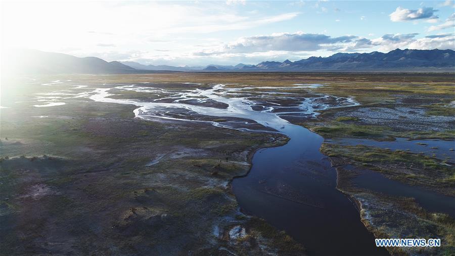
Aerial photo taken on Sept. 9, 2018 shows the scenery of a wetland in Ngari, southwest China's Tibet Autonomous Region. The Ngari area has an average altitude of over 4,000 meters above sea level. (Xinhua/Purbu Zhaxi)
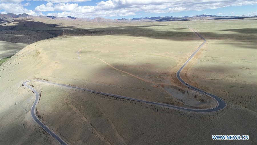
Aerial photo taken on Sept. 10, 2018 shows a view of Zanda highway in Ngari, southwest China's Tibet Autonomous Region. The Ngari area has an average altitude of more than 4,000 metres. (Xinhua/Purbu Zhaxi)
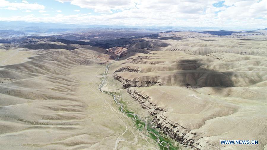
Aerial photo taken on Sept. 10, 2018 shows a stream in valleys of Ngari, southwest China's Tibet Autonomous Region. The Ngari area has an average altitude of over 4,000 meters above sea level. (Xinhua/Purbu Zhaxi)
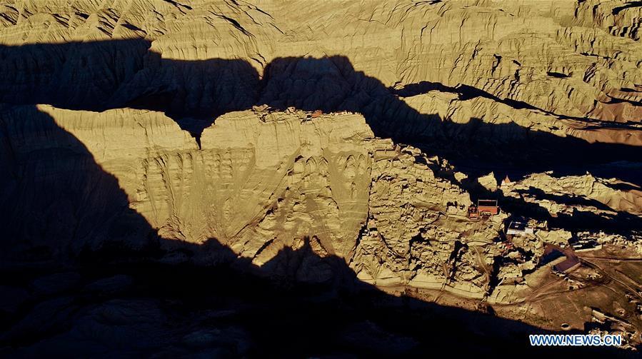
Aerial photo taken on Sept. 11, 2018 shows the ruins of Guge Kingdom in Ngari, southwest China's Tibet Autonomous Region. The Ngari area has an average altitude of over 4,000 meters above sea level. (Xinhua/Purbu Zhaxi)