This photo provided by NASA shows a Delta 2 rocket carrying ICESat-2 lifting off from Vandenberg Air Force Base, Calif., Sept. 15, 2018. NASA Earth Science Division director Michael Freilich says that the mission in particular will advance knowledge of how the ice sheets of Greenland and Antarctica contribute to sea level rise. ICESat-2 is capable of measuring changes in ice thickness, forest growth and cloud height down to 0.02 inches (0.4 millimeters) every year — the thickness of a No. 2 pencil, according to NASA. (Photo/Agencies)
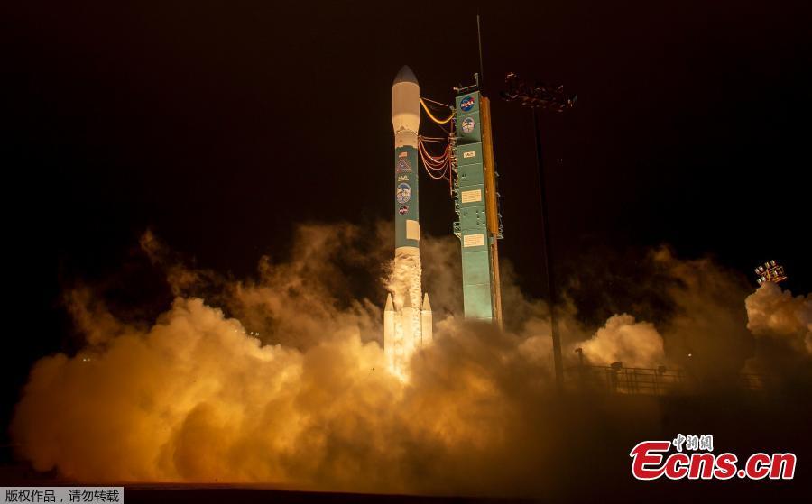
This photo provided by NASA shows a Delta 2 rocket carrying ICESat-2 lifting off from Vandenberg Air Force Base, Calif., Sept. 15, 2018. NASA Earth Science Division director Michael Freilich says that the mission in particular will advance knowledge of how the ice sheets of Greenland and Antarctica contribute to sea level rise. ICESat-2 is capable of measuring changes in ice thickness, forest growth and cloud height down to 0.02 inches (0.4 millimeters) every year — the thickness of a No. 2 pencil, according to NASA. (Photo/Agencies)
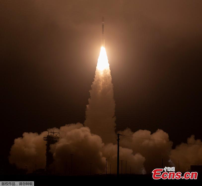
This photo provided by NASA shows a Delta 2 rocket carrying ICESat-2 lifting off from Vandenberg Air Force Base, Calif., Sept. 15, 2018. NASA Earth Science Division director Michael Freilich says that the mission in particular will advance knowledge of how the ice sheets of Greenland and Antarctica contribute to sea level rise. ICESat-2 is capable of measuring changes in ice thickness, forest growth and cloud height down to 0.02 inches (0.4 millimeters) every year — the thickness of a No. 2 pencil, according to NASA. (Photo/Agencies)
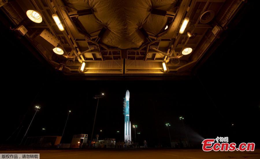
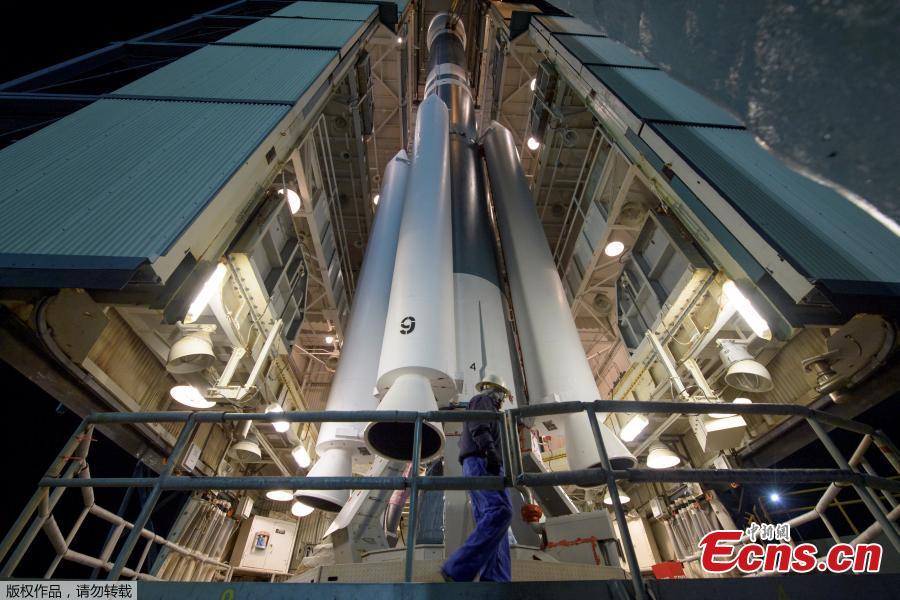
The United Launch Alliance (ULA) Delta II rocket with the NASA Ice, Cloud and land Elevation Satellite-2 (ICESat-2) onboard is seen shortly after the mobile service tower at SLC-2 was rolled back, Sept. 15, 2018, at Vandenberg Air Force Base, Calif. The ICESat-2 mission will measure the changing height of Earth's ice. ICESat-2 is capable of measuring changes in ice thickness, forest growth and cloud height down to 0.02 inches (0.4 millimeters) every year — the thickness of a No. 2 pencil, according to NASA. (Photo/Agencies)
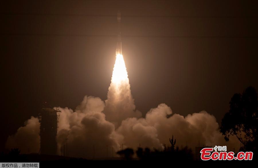
This photo provided by NASA shows a Delta 2 rocket carrying ICESat-2 lifting off from Vandenberg Air Force Base, Calif., Sept. 15, 2018. NASA Earth Science Division director Michael Freilich says that the mission in particular will advance knowledge of how the ice sheets of Greenland and Antarctica contribute to sea level rise. ICESat-2 is capable of measuring changes in ice thickness, forest growth and cloud height down to 0.02 inches (0.4 millimeters) every year — the thickness of a No. 2 pencil, according to NASA. (Photo/Agencies)